Property Record
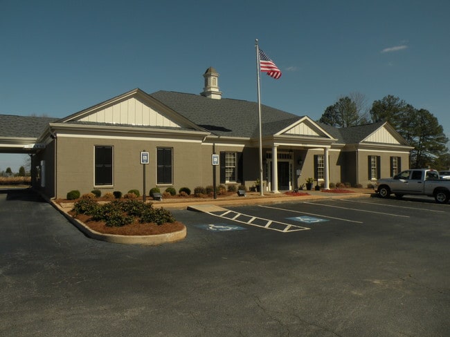
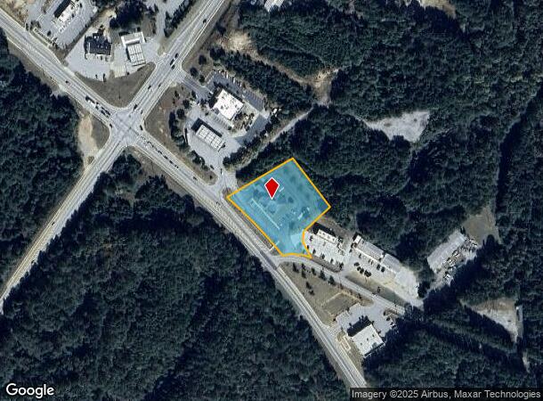
8180 Wells St, Senoia, GA 30276
NEARBY LISTINGS FOR SALE OR LEASE
-
-
View all Senoia listings for sale on LoopNet.com
Property Detail
8180 Wells St
168-1291-009
Martinwood
Financialbuilding
BANK/2.289 AC LL 291 1LD
X
Coweta
13077C0291D
Georgia
2025
1.63 AC
2025
Coweta County
170503
Atlanta
6,808 SF
Atlanta-Sandy Springs-Roswell, GA
DEMOGRAPHICS near 8180 Wells St
1 Mile
3 Mile
5 Mile
2024 Total Population
1,408
9,669
25,573
2029 Population
1,592
10,837
28,146
Pop Growth 2024-2029
+ 13.07%
+ 12.08%
+ 10.06%
Average Age
40
40
40
2024 Total Households
505
3,369
8,787
HH Growth 2024-2029
+ 13.07%
+ 12.20%
+ 10.16%
Median Household Inc
$91,452
$97,150
$96,623
Avg Household Size
2.80
2.80
2.90
2024 Avg HH Vehicles
2.00
2.00
2.00
Median Home Value
$342,307
$348,029
$371,777
Median Year Built
2003
2004
2000
Nearby Places
Map Layers
Map Styles
 Street
 Aerial
- Restaurants
- Banks
- Shops
- Fitness
- Groceries
PUBLIC TRANSPORTATION
AIRPORT
Hartsfield - Jackson Atlanta International
DRIVE
WALK
Distance
Hartsfield - Jackson Atlanta International
45 min
28.0 mi
Nearby Properties
Address
Land Use
TOTAL SIZE
Lot Size
Zoning
Address
Land Use
TOTAL SIZE
Lot Size
Zoning
61,637 SF
10.33 AC
R1
Address
Land Use
TOTAL SIZE
Lot Size
Zoning
66,635 SF
10.90 AC
RFA
Address
Land Use
TOTAL SIZE
Lot Size
Zoning
58,800 SF
11.23 AC
R1
Address
Land Use
TOTAL SIZE
Lot Size
Zoning
78,300 SF
7.49 AC
R1
Address
Land Use
TOTAL SIZE
Lot Size
Zoning
35,914 SF
64.50 AC
Address
Land Use
TOTAL SIZE
Lot Size
Zoning
234,597 SF
13.41 AC
R1
Address
Land Use
TOTAL SIZE
Lot Size
Zoning
234,597 SF
13.41 AC
R1
Address
Land Use
TOTAL SIZE
Lot Size
Zoning
6,080 SF
167.54 AC
R1
Address
Land Use
TOTAL SIZE
Lot Size
Zoning
90,884 SF
109.14 AC
M-C
Address
Land Use
TOTAL SIZE
Lot Size
Zoning
162,400 SF
10.47 AC
M
Address
Land Use
TOTAL SIZE
Lot Size
Zoning
4,965 SF
62.66 AC
R1
Address
Land Use
TOTAL SIZE
Lot Size
Zoning
18,000 SF
18.62 AC
001
Address
Land Use
TOTAL SIZE
Lot Size
Zoning
12,530 SF
0.61 AC
R1
Address
Land Use
TOTAL SIZE
Lot Size
Zoning
16,128 SF
4.55 AC
R1
Address
Land Use
TOTAL SIZE
Lot Size
Zoning
7,544 SF
2.88 AC
C
Address
Land Use
TOTAL SIZE
Lot Size
Zoning
9,322 SF
96.17 AC
RFA
Address
Land Use
TOTAL SIZE
Lot Size
Zoning
10,540 SF
9.66 AC
RFA
Address
Land Use
TOTAL SIZE
Lot Size
Zoning
19,800 SF
0.15 AC
C1
Address
Land Use
TOTAL SIZE
Lot Size
Zoning
13,930 SF
2.22 AC
R1
Address
Land Use
TOTAL SIZE
Lot Size
Zoning
7,167 SF
11.19 AC
C
Address
Land Use
TOTAL SIZE
Lot Size
Zoning
10,004 SF
1.49 AC
001
Address
Land Use
TOTAL SIZE
Lot Size
Zoning
5,004 SF
1.62 AC
001
Address
Land Use
TOTAL SIZE
Lot Size
Zoning
50,000 SF
3.80 AC
C
Address
Land Use
TOTAL SIZE
Lot Size
Zoning
34.20 AC
Address
Land Use
TOTAL SIZE
Lot Size
Zoning
19,650 SF
0.15 AC
C1
Address
Land Use
TOTAL SIZE
Lot Size
Zoning
7.70 AC
C
Address
Land Use
TOTAL SIZE
Lot Size
Zoning
6,572 SF
5.17 AC
R1
Address
Land Use
TOTAL SIZE
Lot Size
Zoning
173.50 AC
Address
Land Use
TOTAL SIZE
Lot Size
Zoning
16,253 SF
2.50 AC
R1
Address
Land Use
TOTAL SIZE
Lot Size
Zoning
12,816 SF
1.08 AC
R1
The World's #1 Commercial Real Estate Marketplace
Connect with us
© 2026 CoStar Group
The information above has been obtained from sources believed reliable. While we do not doubt its accuracy we have not verified it and make no guarantee, warranty or representation about it. It is your responsibility to independently confirm its accuracy and completeness. Any projections, opinions, assumptions, or estimates used are for example only and do not represent the current or future performance of the property. The value of this transaction to you depends on tax and other factors which should be evaluated by your tax, financial, and legal advisors. You and your advisors should conduct a careful, independent investigation of the property to determine to your satisfaction the suitability of the property for your needs.